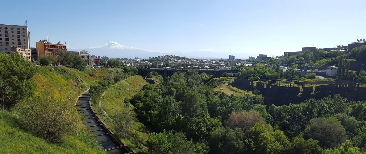

Hrazdan Gorge in Yerevan
A long natural corridor through the capital, combining a river, basalt slopes, bridges, parks and city history


Hrazdan Gorge in Yerevan is not one address or a single park. The river crosses roughly 15 km of the capital, while neighborhoods, roads and bridges divide the gorge into very different sections. Typing only “Hrazdan Gorge” into a map is therefore not enough: first decide whether you want a broad city view, an easy park visit or a walk closer to the water.
Choose the lower city section for the panorama
Around Victory Bridge and the Yerevan Brandy Company, the gorge is read from above. One frame can hold green slopes, the bridge, city roofs and, in clear weather, Mount Ararat. This works well for a short viewpoint stop, but do not pause in traffic lanes or cross beyond protective barriers. Morning and late-afternoon light reveal the slope more clearly.
Use a park entrance for an easier walk
Tumanyan Park near Kievyan Bridge and New Arabkir Park farther north provide clearer starting points near the gorge. They do not form one guaranteed continuous trail, so never plan to walk the whole ravine without checking an exit. The official Visit Yerevan overview also identifies these recreation sectors.
Observe the river from the bank
The Hrazdan may look calm, yet current, depth and channel conditions change from one point to another. Do not swim, hop across on rocks or leave children and pets alone at the edge. Damp soil and mossy stones are slippery after rain. If a path is closed, abandoned, or leads toward a tunnel or railway area, turn back to a public route.
The rock is a natural cross-section of the city
Dark basalt outcrops show that this is more than a green strip below the streets: it is a deep valley cut through volcanic rock. Notice how natural faces meet masonry retaining walls and arches. Because loose rock can fall, avoid unmarked slopes below cliffs and stay away from collapsed edges.
Finish the route back in the upper city
From the lower sector, climb toward the ARARAT Brandy Museum, then walk through the Kond Historic District or visit the Yerevan History Museum. Find more nature and city stops in GAVAG’s Armenia attractions guide.
Frequently asked questions
Book a private transfer
Add this stop to your trip, see the full route on the map, and compare offers from local drivers.