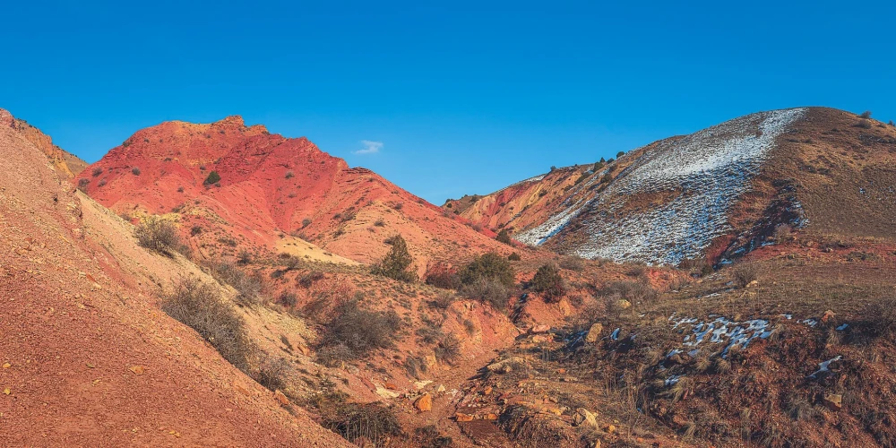

Yeranos Mountains
A dry ridge where rock color, slope and horizon tell three different stories


The Yeranos Mountains are one of the most striking hiking areas near Yerevan. There are few trees, marked tourist paths or roadside facilities here. Instead, the route passes bare rock, semi-desert slopes and open viewpoints above Azat Reservoir. The landscape is especially attractive in early spring and late autumn, when temperatures are milder and the colours of the rock are easier to see.
What makes the Yeranos range distinctive
Yeranos is a south-western branch of the Geghama highlands. The range stretches for roughly 23 km, and its highest point, Mount Yeranos, reaches about 1,824 metres. Northern and north-western slopes are short and steep, while the southern side is generally gentler. Shade is scarce across the dry mountain-steppe landscape. Armenian Geographic provides additional geological and route background in its Yeranos overview.
Pink Gorge and the colour of the rocks
Pink Gorge is one of the best-known parts of the range. Depending on the angle of the sun, the rock shifts between pale pink, ochre and reddish brown. Natural branching mineral patterns can also be seen on some surfaces. Photograph them without breaking or removing stones from the site.
Choosing a suitable route
There is no single trail designed for every visitor. Short outings usually focus on Pink Gorge and nearby viewpoints. Experienced hikers may choose the long Garni–Azat Gorge–Yeranos ridge–Lanjazat traverse, which can reach 25-28 km. That option requires a full day, good fitness and navigation experience. First-time visitors should choose a shorter route or join an experienced local guide. Download the map before departure and share the expected return time with someone.
Views from the ridge
Open sections overlook Azat Reservoir; in clear weather, Mount Ararat, Aragats and the Geghama Mountains may also be visible. Morning and late-afternoon light are usually best for photography. Keep away from cliff edges, where loose ground and sudden wind can make footing unsafe.
What to bring
There are no reliable springs or services along most routes. Carry 2-3 litres of water per person, food, sun protection, a small first-aid kit, a charged phone and supportive hiking footwear. Avoid exposed routes during extreme summer heat, thunderstorms, and immediately after heavy rain or snow. Parts of the north-western slopes belong to Khosrov Forest State Reserve, where official access rules must be respected.
Combining Yeranos with nearby places
After a short hike, continue to Azat Reservoir or Garni Gorge. A cultural route can include Garni Temple and Geghard Monastery. Do not add extra sightseeing to the full 25-28 km traverse; that hike already fills an entire day.
Approach and turnaround: access roads and trailheads vary between routes, and ordinary cars may not suit rough sections. Confirm the starting point with a current local source. Turn back if wind affects balance, thunder develops, visibility falls, or the group has used half its water before reaching the planned midpoint.
Frequently asked questions
Book a private transfer
Add this stop to your trip, see the full route on the map, and compare offers from local drivers.